With its wide plains, majestic lakes, and stunning volcanoes, Hokkaido boasts an incredible amount of geographical variety. In this article, we will take a look at the make-up of Hokkaido, examining the prefecture’s geography in detail.
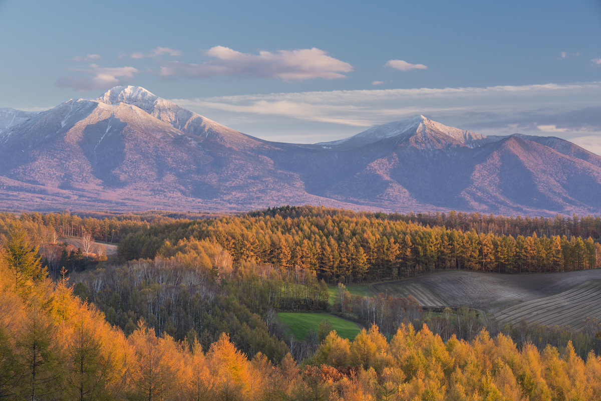
Photo: Biei Hill is an example of a pyroclastic hill and is representative of Hokkaido’s geography. Taking advantage of the topography, the area is famous for potato and corn farms. Ⓒ Jiro Tateno / SEBUN PHOTO / amanaimages
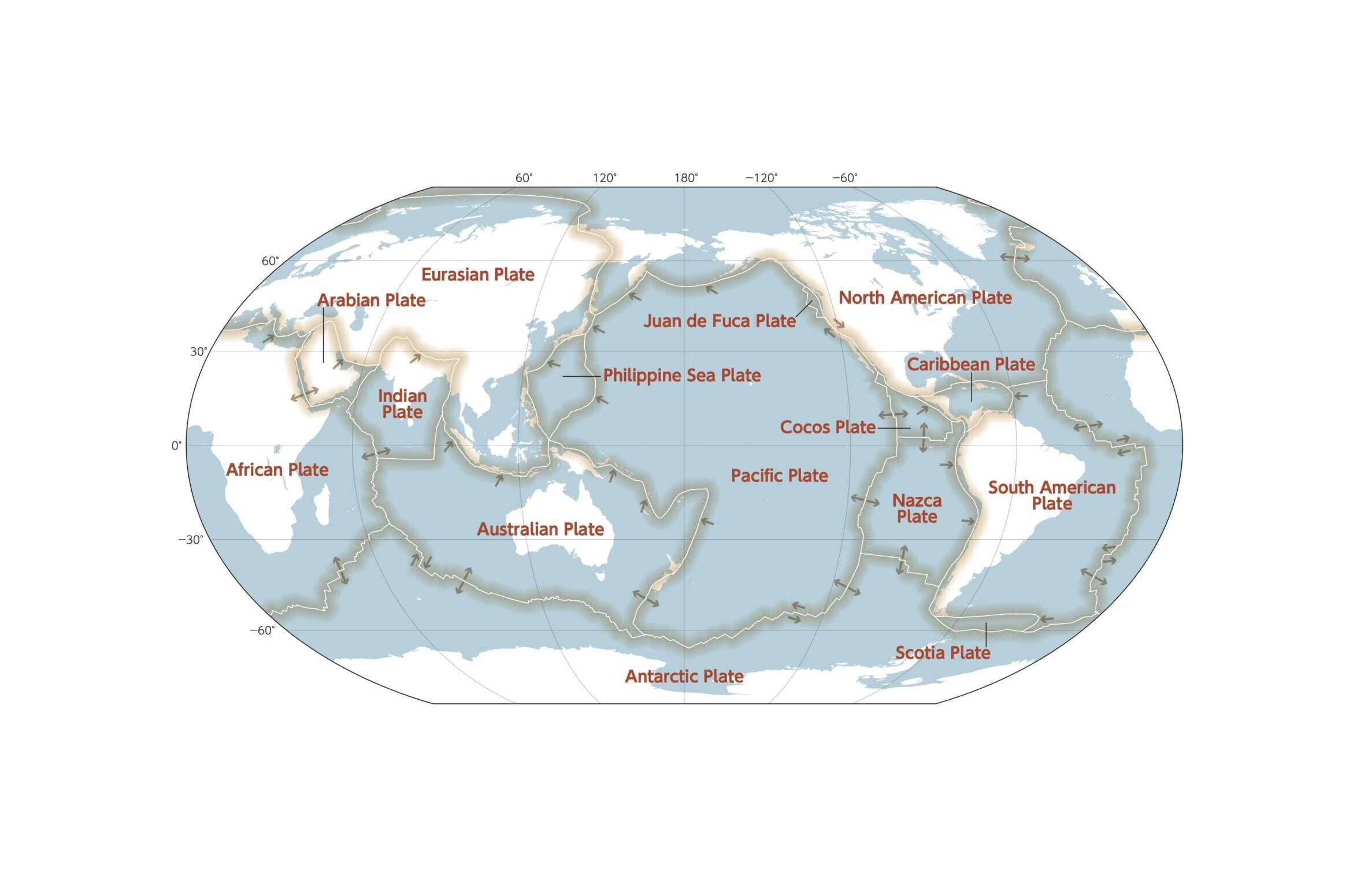
To outline Hokkaido’s topography and geology, we have enlisted the support of Hirose Wataru, a geologist working at a local research institute. “The topography of Europe and the Eastern part of America is comparatively “gentle”, meaning mostly free from sudden, steep topographical changes. Hokkaido, on the other hand, features a varied terrain of tall mountains interspersed with valleys, rivers, and hills for a unique landscape” says Hirose. The key to understanding this variety lies in the position of tectonic plates. Hokkaido is located at the boundary between the Eurasian and North American Plate. When two plates collide, the continental crust buckles, and rock piles up, creating mountain ranges. In the case of Hokkaido, this explains how the Hidaka Mountains were birthed. Simultaneously, deep valleys are carved through rainwater. On the other hand, Europe and America are located at a distance from tectonic plate boundaries, explaining the abundance of flat plains in their geography.
Furthermore, Hirose points to the area’s relatively young geological age and variation as another characteristic of Hokkaido’s geography: “The land that eventually formed Hokkaido was originally located somewhere completely different, gradually assembling over a period of tens of millions of years. It took its current form an estimated 20 million years ago.”
Furthermore, Hokkaido also features permafrost – the state of the ground being frozen year-round. In modern Japan, the only two places with permafrost are Daisetsuzan in Hokkaido and Mount Fuji. Hirose explains that “about 20,000 years ago, the climate in Hokkaido was much cooler than it is today. It’s land thus underwent a constant cycle of frosting and melting. While melting, the soil then loosens and flows down slopes, making the undulations in the terrain gentler. Areas that exhibit such features are called periglacial landforms. In Hokkaido, we can find such landforms at the Soya Hills in Wakkanai.”
Another landform unique to Hokkaido is pyroclastic plateaus. These are plateaus formed when a huge amount of volcanic ash is blown out from the volcanic crater (caldera) and flows down to the surrounding areas (pyroclastic flow). Examples of pyroclastic plateaus can be found in Biei or Memanbetsu, with the seemingly endless sloping hills making these areas popular with photographers and tourists.
To further explore Hokkaido’s unique geography, Hirose went on to share two of his favorite spots: “First, I would like to highlight Showa Shinzan, which is located within the TOYA-USU Global Geopark. This is a mountain created between 1943-1945 due to the frequent eruptions of Mount Usu, in an area that originally was home to small settlements and wheat fields. Though it has been more than 70 years since its formation, the mountain still erupts very frequently. While you are there, make sure to also visit the Masao Mimatsu Memorial Hall.” When Showa Shinzan was first in the process of being formed, Masao, a local postmaster, took it upon himself to carefully record relevant data crucial to understanding the mountain. These records and more exhibited in the Memorial Hall. Not only does the park boast academically valuable exhibits, but it is also recognized as a Unesco Global Geopark for its conservation and educational activities.
-
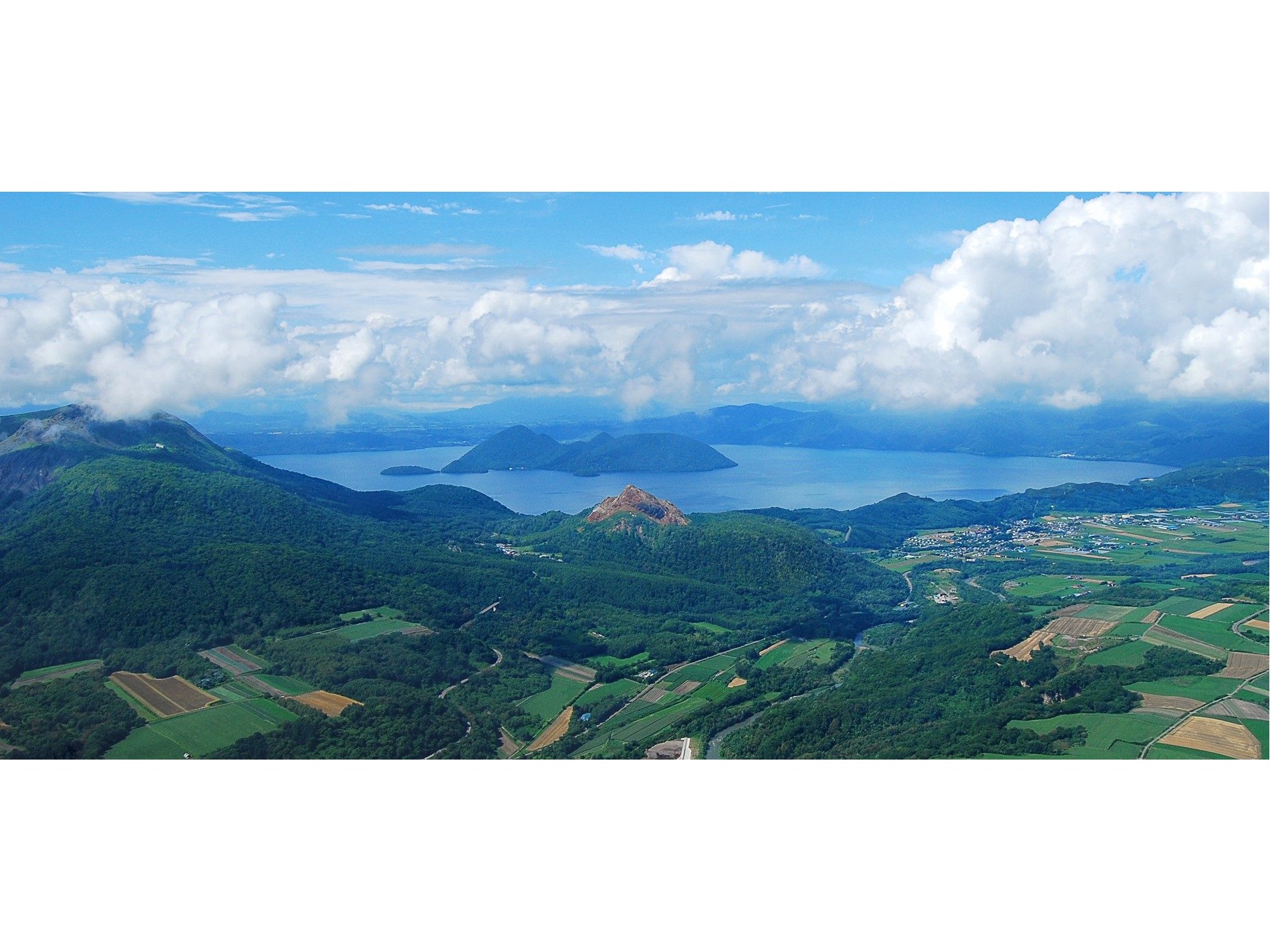
Lake Toya, created about 110,000 years ago due to a major volcanic eruption. On the left, Mt. Usu is an active volcano that has erupted frequently for tens of thousands of years. Recently, it has erupted once every few decades. Showa Shinzan was created at Mt Usu’s foot due to constant eruptions in the early 1940s. photo: Toya-Usu UNESCO Global Geopark Council -
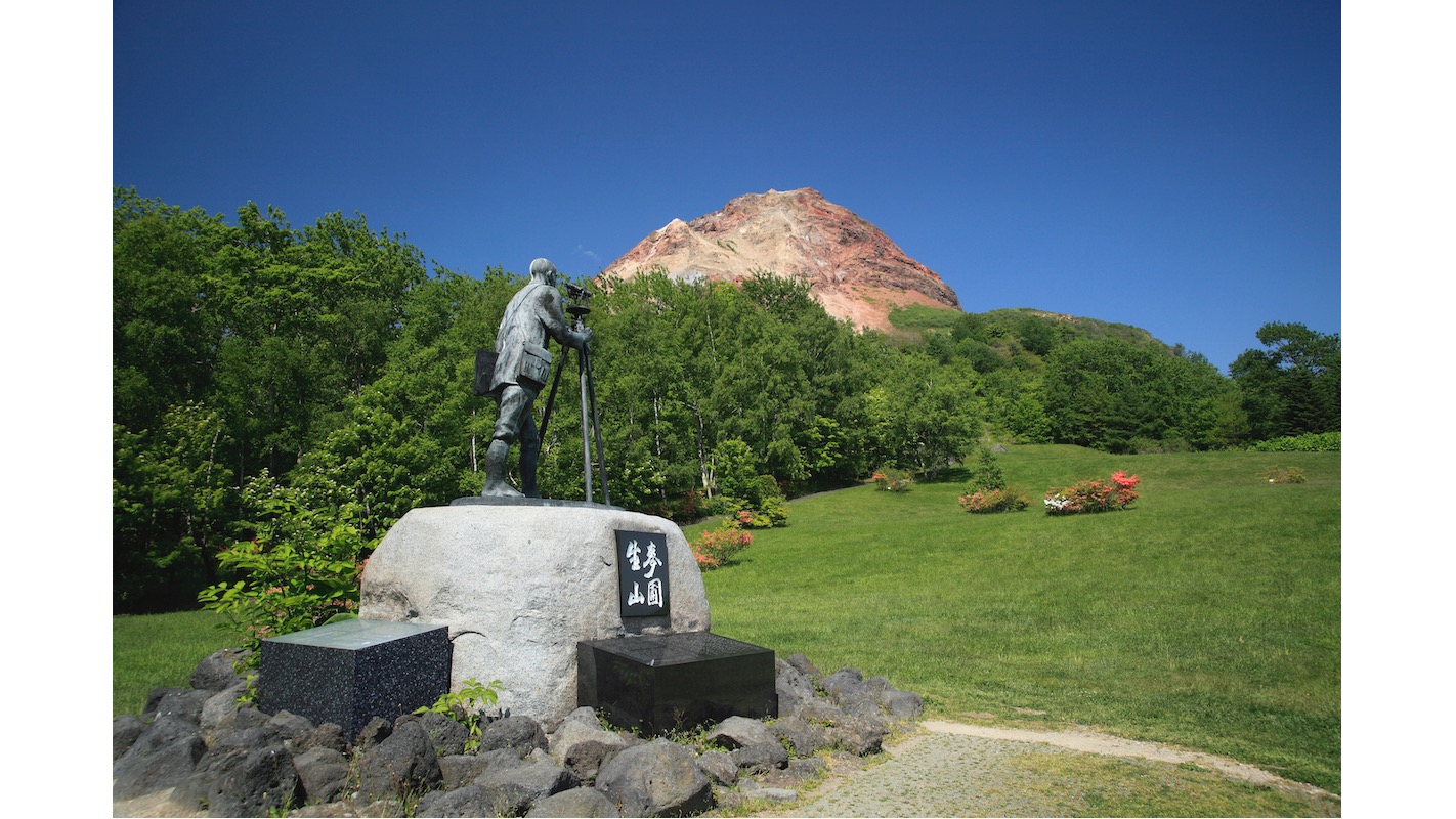
Showa Shinzan, which is designated a Special Natural Monument. At the mountain’s foot, a statue dedicated to Masao Mimatsu, who spent many years of his life recording relevant data with regards to Showa Shinzan’s formation. photo: ©spo/a.collectionRF /amanaimages -
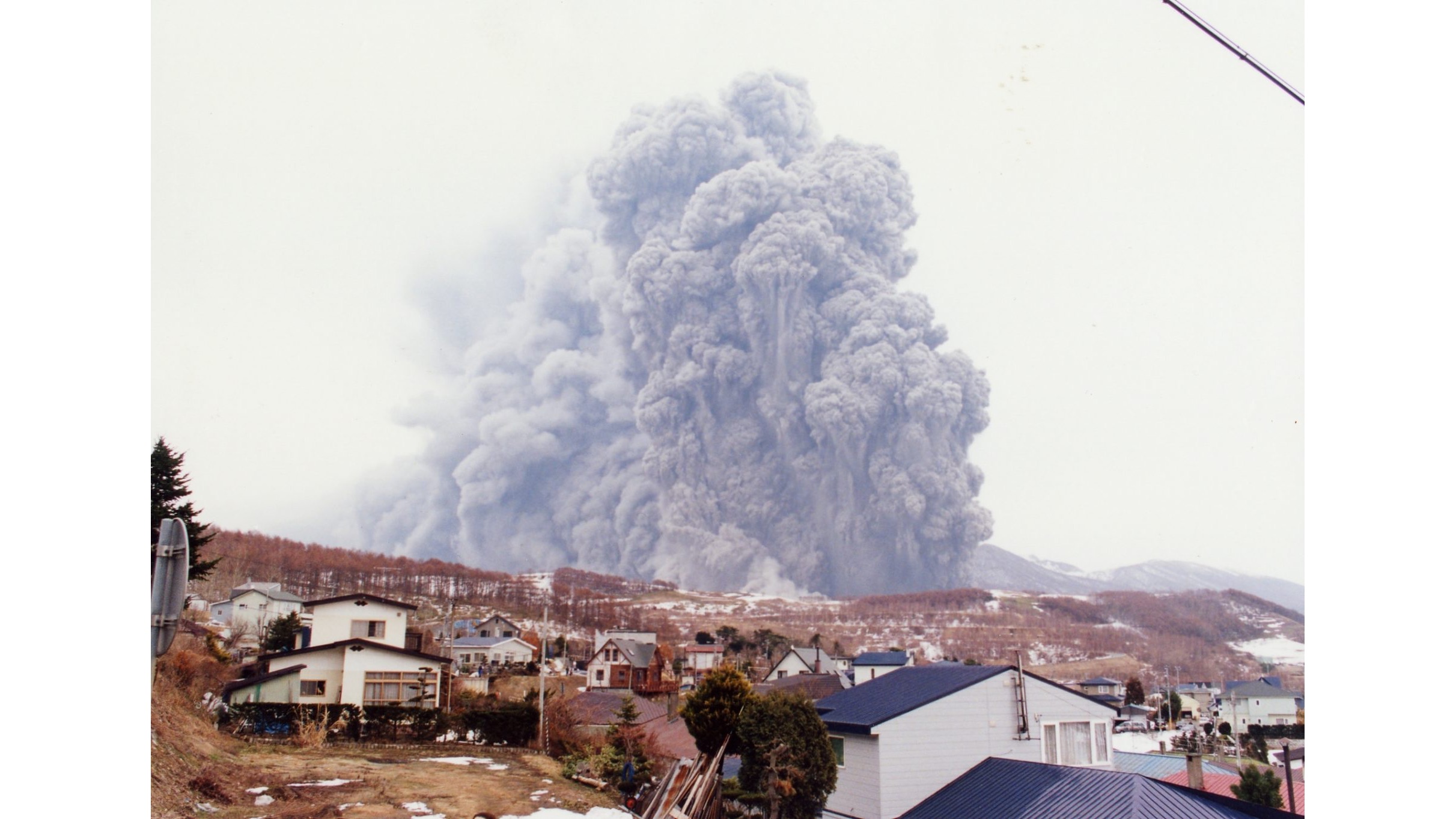
Mt. Usu when it erupted in 2000. As premonitory earthquake symptoms were occurring, visitors and local residents were able to evacuate resulting in no human damage. photo: Toya-Usu UNESCO Global Geopark Council
Hirose’s second recommendation is the Mikasa Geopark, famous for ammonite. He goes on to explain that “Mikasa, located in the central area of Hokkaido, used to be the site of the Horonai Coal Mine, the first of its kind in the region. In 1876, Benjamin Smith Lyman published the first major geographical paper about Japan, his “Geological Sketch Map of the Island of Yesso, Japan”. In it, he describes testing coal recovered from 50-million-year-old strata, in which a 100-million-year-old ammonite from the Cretaceous Period was discovered. The find propelled Hokkaido towards being a hotspot for ammonite research.”
How was Lyman able to find 100-million-year-old ammonite inside of 50-million-year-old strata? “To answer this question, we must take a look at the geology of Mikasa. 100 million years ago, Mikasa was surrounded by sea, in which ammonites lived. The strata that had accumulated at the ocean floor was then eroded when the tectonic plates collided and were eventually surrounded with strata from the 50-million-year-old river” explains Hirose.
-
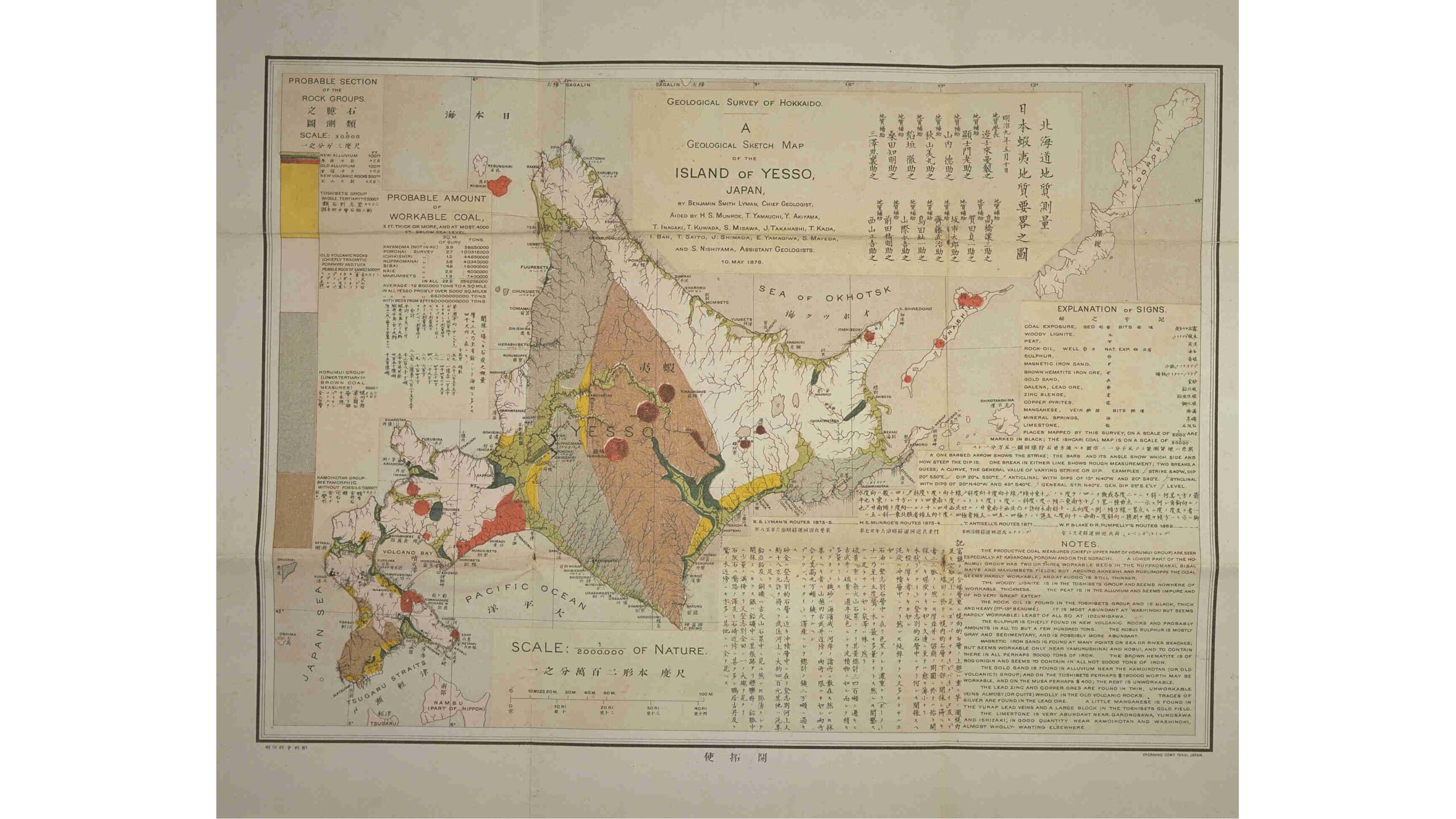
Lyman’s “Geological Sketch Map of the Island of Yesso, Japan” published in 1873. The examination of underground resources was seen as an important step towards modernization in Japan at the time. The map’s publication date, May 10th, is designated as “Geology Day” in Japan. photo: Hokkaido University Library -
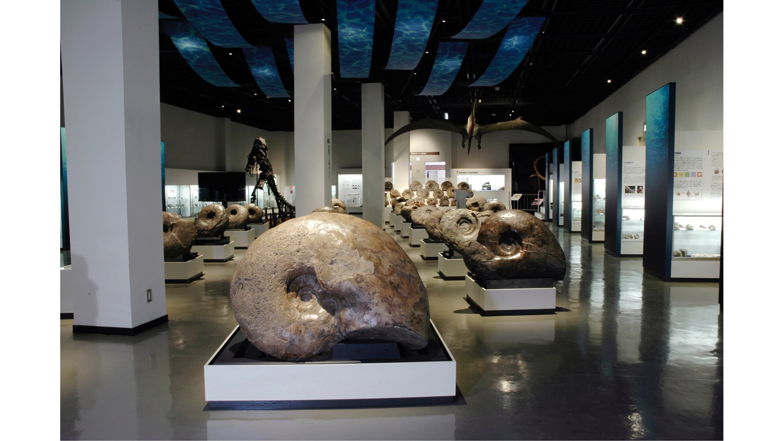
Mikasa City Museum, which features more than 1000 fossils including ammonites found in the area. Being able to get up-close to large ammonites and the fossil of the Taniwhasaurus Mikasaensis (a large reptile found in the ocean) makes the experience worthwhile. photo: Mikasa City Museum -
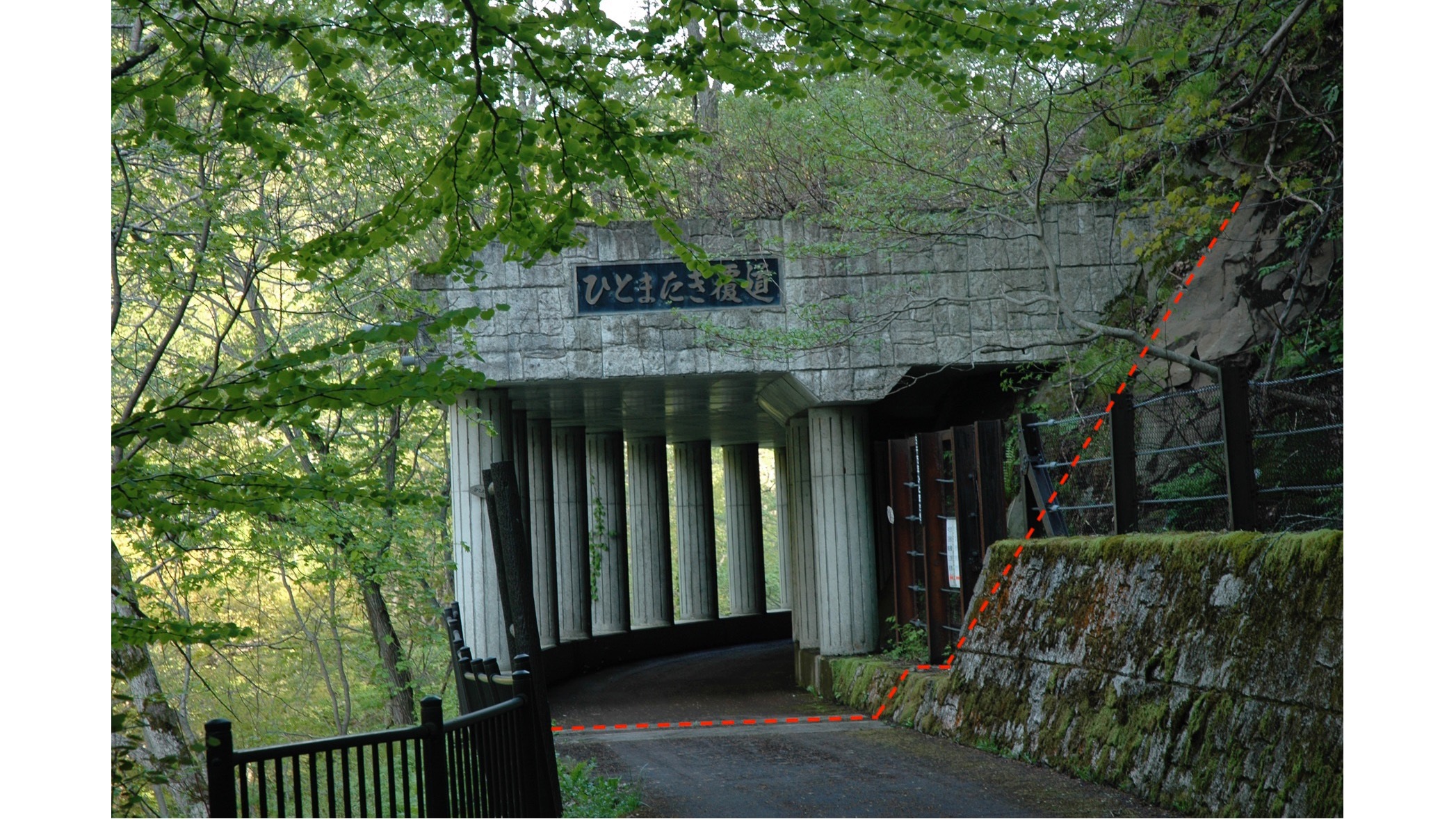
Hitomatagi-Fukudo. The red line indicates the boundary between the strata. Before it, the strata is 50-million-years old, while the strata past the line is 100-million-years old. photo: Mikasa City Museum
In Hokkaido, you can actually experience this 50-million-year difference at the “Hitomatagi- Fukudo”, located about 15 minutes by foot from the Mikasa City Museum. This spot represents the boundary of the two strata discussed above, meaning that you can travel millions of years in just a single stride. Additionally, the museum features massive ammonites in addition to the remains of the coal mine. It all makes for a deep dive into the very fabric of our earth’s history. That is why, on your next trip to Hokkaido, we highly recommend looking beyond the beautiful landscape to understand how it was formed – we guarantee that you will gain a new appreciation of our planet.

Hirose Wataru
A specialist in geography and geology, he gained his Ph.D. from Hokkaido University in 2001. Currently, he is working at the Hokkaido Research Organization (a Local Independent Administrative Agency) as the Chief for Geoinformation and Social Geology within the Industrial Technology and Environment Research Department.